Wednesday, April 15, 2015

Satellite images of lakes and reservoirs help second graders understand the value of water

Second graders in the Indian Paintbrush Elementary School (IPES) saw how satellites collect data about Earth from space and how those data are used for monitoring water bodies such as lakes and reservoirs around the world.

Students are learning about water (part of the second grade core curriculum standard) and its importance to humans, other living beings, and environment. With the help of historical and present satellite images, students were able to visualize the impact of a) diverting water from rivers made a sea disappear (Aral Sea), b) precipitation and drought on reservoirs in Wyoming, and c) runoff from crop fields and other effluents in Lake Erie and Gulf of Mexico. Students were able to see how human actions, small and big, influences water quantity and quality.

Describing the value of these images, Genee Witte, one of the second grade teachers in IPES, said, “It was very exciting and extremely helpful for the second graders to see the images ...  It helped build their background knowledge of the changes the lakes, etc. undergo. … The images of the disappearing sea and the images of the effect that pollution has on the water and us made us all take a moment to think about how we can make a difference.  … Having the images shown to the students helps them to retain the information!  They are able to keep that image in their mind and add to their background knowledge.”

Julie Howard, another second grade teacher, was able to talk “about the map of the Great Lakes.  Some of them had just read a story about Paul Bunyan and how he formed these lakes. This then lead to a discussion of where water came from to fill these lakes and then looking at a map to follow the Mississippi River. We discussed how and where water flows by referring to maps.” Stacy Hoffer, who teaches the third section of second graders, commented the images were “very informative and my students enjoyed it. The presentation on water created more discussion in my classroom.”

Changes occurring in the Aral Sea captivated the minds of most students. Student teacher Shawna Black commented “ [T]he students have continued to talk about the magically disappearing act of the Aral Sea, and have asked if we can look at more pictures of bodies of water to see if it affects other places since you showed us the amazing satellite images.”

Students wrote about what they learned from these talks and their responses are summarized in the following word cloud:


Sivanpillai visited these classrooms on April 1, 2 and 15, 2015, as part of the WyomingView’s Earth Observation Day (EOD) and Wyoming Center for Environmental Hydrology & Geology (WyCEHG)’s K-12 outreach activities.

Friday, December 12, 2014

Monitoring our changing environment using satellite images: Earth Observation Day activities in UW Lab School

Sixth grade students at UW Lab School saw how nature and man-made changes have altered Earth’s surface. As part of the WyomingView Earth Observation Day activity (Dec 5 and 12, 2014), sixteen students were introduced to data collection in the visible and invisible portions of the electromagnetic spectrum.

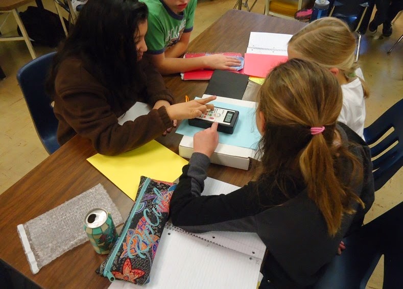
Measuring spectral reflectance of color papers using ALTA II Spectrometer

After introducing electromagnetic spectrum in his sixth grade class, Andy Pannell, invited WyomingView PI to his class for describing how scientists collect and analyze spectral data. First, students collected spectral reflectance of colored papers and compared their reflectance patterns. Students then learned that satellites collect similar data using very sophisticated and expensive sensors, and the data collected over the past several decades can be used for mapping changes in the landscape. Pannell commented that the “incredible satellite images that helped our students see the usefulness of these understandings, as well as wavelengths outside the visible spectrum, in a real-world context.”

Student feedback about remote sensing and its benefits to society are listed below (students are identified by initials for privacy purposes):

“It helped me with understanding radiation because I couldn’t see what was happening but something was [happening] and it was AMAZING”

“Showed us how people use thermal scans to find wildfires” G

“Helped me understand how using IR and UR might be helpful to find different info.” HB

“Showed me that different colors reflect different amount of light” Z

“Makes things look so different” SH

“Those images were surprising and they helped [me] to understand electromagnetic radiation”

“I know that the [satellites] are really important to see our earth” SS

“Showed me reflecting lights of the trees, and it also showed the bad and good ones” CD

“Showed us how people use different ways to show wildfire, water shortages, bad soil etc.”

Wednesday, May 14, 2014

WyomingView interns describe how satellite data can be used for monitoring past environmental changes

Emily Richardson (BS Botany) monitored aspen tree growth in normal, wet, and dry years along an elevation gradient in the Sierra Madre Mountains. She computed a vegetation index from Moderate Resolution Imaging Spectrometer (MODIS) data acquired in 3 years and analyzed tree growth based on their phenology curves. Aspen stands growing at lower elevations exhibited major changes during these three years, whereas their growth patterns at higher elevations did not show such variations.


Ryan Lermon (BS Rangeland Ecology & Watershed Management) mapped the burn severity at a prescribed fire site north of Rawlins, WY. Prescribed fires are part of forest management methods aimed at reducing fuel load, and improving overall habitat quality. Following a prescribed fire event, land management agencies are required to map how fire moved through the landscape but lack the necessary resources to generate it. Using a Landsat 8 image acquired after the fire, Ryan mapped the impact of this prescribed fire as high, medium, low and no-burn classes. This map will be used by agencies to establish field sampling plots for monitor vegetation regrowth.


Emily and Ryan presented their work in the Wyoming Undergraduate Research Day on 26 April 2014.


Following newspapers published a short description of Emily's work:


Laramie Boomerang - May 10, 2014 - Link to article

Casper Star Tribune - May 12, 2014 - Link to article

Washington Times - May 10, 2014 - Link to article

Monday, March 31, 2014

Eighth graders associate spectral reflectance patterns with plant form, health status

Eighth grade students at Laramie Junior High School learned to measure the spectral reflectance of leaves and analyze differences based on their types (conifers vs. deciduous) and health status (live vs. dying) during presentations by Ramesh Sivanpillai, principal investigator for WyomingView. The more than 75 students also learned how sensors in remote sensing satellites collect similar data about Earth surface features.

Students providing their feedback on remote sensing concepts and the hands-on activity that aimed at comparing spectral reflectance values of live vs. dead leaves from conifer and deciduous trees.

Ron Whitman, physical sciences teacher at the school, invited Sivanpillai to four sections of his eight grade classes to highlight remote sensing science and applications. “Ramesh introduced the electromagnetic spectrum with a very informative power point presentation during class period[s,]” he said. Whitman trained students to collect spectral data of the leaves, enter them in spreadsheet, and analyze them. This year’s activities spanned four class periods. “I was able to teach, on my own, the aspects of remote sensing, collection of data, displaying data and interpreting research data as initially taught by Ramesh,” he said.

Whitman noted the students continue to be excited about remote sensing and simple and complex tools. “Students compared their own data and other students’ data and discussed what was similar, different, and reasons for error,” he said. “Ramesh came back and helped students interpret their data and compare to other practical research by colleges and college students.”

WyView coordinator discuses phenology and leaf color changes in aspen trees

Student feedback highlighted different aspects of this lecture and hands-on exercise. Students are identified by initials for privacy purposes.

"I learned that the spectral reflectance values of things make a big difference in the world." KD

"I learned that the colors that you can see are based on what colors are reflected of of the object." KW

"I have learned that plant give off infrared radiation waves. They help us tell if the plant is healthy." DR

"I learned how to graph on the excel and I learned how to use a spectrometer" MH

"I also learned how satellites check out the environment from space from all around the world ... we learned how to plot and compare reflectance values." SH

"In the hands on activity I learned how to calculate the percent of reflectance of colors." CH

"I learned that live leaves reflect more than dead leaves." NT

"We also learned how to use Microsoft Excel and how it can graph scientific data." JW

"... a live leaf absorbs more of every other color but reflects green the most." SH

"I can definitely say that I learned new information about electromagnetic radiation and how it affects the colors that are visible for different species." KW

This event was conducted on March 31, April 1, 2, 8, 9 and May 19 as part of AmericaView’s Earth Observation Day activities aimed at introducing remote sensing science and applications to K-12 students and teachers.

Friday, March 14, 2014

Conner’s aspen phenology study wins third place in the 2014 Wyoming State Science Fair

Conner Whitman, an 8th grader in Laramie Junior High School, monitored leaf color changes in 3 aspen trees for 29 weeks (May – Oct 2013) by measuring their spectral reflectance values every week.

His research focused on how age and health status of these aspen clones influenced the changes in their leaf pigments. Every week starting in the spring, he collected leaves from 2 healthy (young and old), and 1 stressed (young) aspen trees and measured the amount of light reflected in eleven different wavelengths.

For comparison he also measured light reflected by an Engelmann spruce. Most conifer trees like Engelmann spruce do not exhibit prominent leaf color changes.
Using the amount of light reflected in infrared and red portions of the spectrum he calculated the different index which can be related to the amount of leaf chlorophyll content in each tree.


His results (figure above) indicated that the rate of chlorophyll change was influenced by health status of individual aspen trees within a clone. However there was no difference between the young and old healthy aspen trees. The light reflected by Engelmann spruce steadily increased throughout the year and did not show the declining trend in fall season.


Conner presented his research findings in the 2014 Wyoming State Science Fair in Laramie on 3/4/2014 and won the third place in the Plant Sciences category.

Tuesday, March 4, 2014

Abigail’s study on the effect of rain on urban heat island wins a Certificate of Achievement from NCAR and third place in the 2014 Wyoming State Science Fair

Abigail Whitman, a 6th grader in Laramie’s Snowy Range Academy, studied how afternoon rain showers in summer altered the urban heat island effect.

Temperature data collected by her at 3 outdoor locations on 12 days revealed that concrete, grass, and asphalt surfaces rapidly cooled following PM rainfall events in comparison to non-rainy days. Temperatures of all three surfaces dropped gradually on sunny days with no rain. At the end of the day, asphalt and concrete recorded higher temperatures than grass lawns. On rainy days temperatures of these surfaces dropped rapidly following the rain event. However the pattern of temperature drop of these three surfaces did not change. Her research revealed that in addition to rain, wind and clouds also influenced the rate of decrease in temperature of these surfaces.


Abigail presented her research findings in the 2014 Wyoming State Science Fair in Laramie on 3/4/2014 and won the third place in Earth and Planetary Sciences category.  Additionally she was awarded a Certificate of Achievement from the National Consortium for Atmospheric Research (NCAR) in the Junior Geoscience division.

Friday, September 27, 2013

WyomingView sponsored students present their research findings in 2013 Geospatial Conference of the West (GeCo West) Conference


Four WyomingView sponsored students presented their research about the urban heat island effect, image analyst bias and utility of indices to map water bodies in the recently concluded 2013 GeCo West Conference in Laramie, WY. WyomingView coordinator mentored these students on these projects.


Sarah Arulswamy, a 9th grade student at Laramie Junior High School, has been studying the urban heat island effects in Laramie since summer 2012. Earlier she presented her findings based on summer, fall and winter data in the 2013 Wyoming Science Fair. She continued her study in spring 2013 and presented the findings in this conference. Urban heat island effect was evident in spring but at a much lesser magnitude than what she observed in 2012 summer (Figure below).


Bailey Terry (BS Rangeland Ecology & Watershed Management) has been estimating analyst bias introduced during Landsat image classification. She described how small differences introduced by the analysts during the interpretation process influences area estimates of earth surface features.


Kaitlyn McCollum (MS Agricultural Economics) and Matthew Thoman (BS Rangeland Ecology & Watershed Management) tested the transferability of threshold values of commonly used indices for mapping water bodies. In their talk they described how well threshold values generated for one water body can be transferred to other water bodies in space and time.


Additional photos from these presentations can be found at WyomingView’s Google+ site.

Tuesday, September 17, 2013

WyomingView workshop highlights the value of no-cost Landsat data for natural resources monitoring

WyomingView coordinator Ramesh Sivanpillai described how no-cost Landsat data can be used for monitoring and mapping natural resources in one of the several pre-conference workshops of the 2013 Geospatial Conference of the West held in Laramie, WY. Participants were introduced to remote sensing basics and data characteristics in order to provide an overview of various data sources along with various advantages of Landsat data.

Landsat data constitute the longest collection of remotely sensed earth observations. Starting 2008, the US Geological Survey (USGS) has made the entire Landsat data archive available to users at no-cost which has created an unprecedented opportunity for monitoring and mapping changes to the earth’s surface features.


Participants were introduced to similarities and differences among data collected by various Landsat satellites and how to search and download them for their area of interest from USGS’ web portal - Earth Explorer (earthexplorer.usgs.gov). More information about Landsat data can be found at: landsat.usgs.gov.

Tuesday, June 11, 2013

Researchers generate crop growth patterns for Wyoming farmlands from satellite images

Article originally published in Reflections a publication of the UW College of Agriculture and Natural Resources (Publication date: June 2013; pages 40-42)

Access the issue online at: http://www.uwyo.edu/uwexpstn/publications/reflections/reflections-2013-web.pdf (4.2MB)

* * * * * * * * * * *

Researchers generate crop growth patterns for Wyoming farmlands from satellite images

Under precision-agriculture or site-specific management practices, farmers split fields into discrete zones based upon underlying soil properties and past crop growth patterns. By dividing the field into zones, a farmer can devote more resources to zones with medium to low growth to increase output.

Remotely sensed data (images) of crop growth acquired during the growing season in multiple years are essential to understand and map differences in crop growth through time. Data collected in the infrared region (invisible to human eyes) are particularly useful to distinguish differences in crop growth in a field. 

Advances in technology are enabling us to acquire remotely sensed images using sensors mounted in balloons, unmanned aerial systems, or farm vehicles (tractors and trucks, for example). 

Images collected by Landsat satellites date back to the early 1970s and comprise the longest and one of the most complete collections of remotely sensed images. Since these images are acquired once every 16 days, farmers can use them to monitor growth patterns during one or more growing seasons. 

In 2008, the U.S. Geological Survey (USGS) opened the entire Landsat image archive free to users. Now any user can download images directly from the USGS websites http://glovis.usgs.gov or http://earthexplorer.usgs.gov. 

Infrared images acquired by a Landsat satellite show changes in crop growth during the 2007 growing season. Crops with high growth (or vigor) appear bright red due to more reflection in the infrared region. Darker shades of red indicate medium- to low-growth areas. Harvested areas and bare ground appear in shades of green and blue.


University of Wyoming students enrolled in the remote sensing for agricultural management course are taking advantage of this to monitor fields in Wyoming or their home states. 

Monitoring crop growth in one growing season

Carson Hessenthaler, agricultural business major from Lovell, compared sugar beet growth in a field near Lovell that had uneven soil fertility. Using three Landsat images acquired at different times of the year, he tracked growth in areas that showed poor, medium, and high growth at the start of the growing season (Figure 1).
Figure 1: Landsat images revealed differences in the sugar beet growth for the
2011 growing season at a farm near Lovell.
His analysis revealed that areas with high-, medium-, and poor-growth patterns at the start of the season stayed more or less same until the end of the season. However, areas with poor growth at the start had relatively more growth, albeit small, throughout the season and ultimately narrowed the gap with the other two categories. 

Mapping crop growth between growing seasons

Matthew Thoman, rangeland ecology and watershed management major from Riverton, mapped winter wheat growth patterns in non-irrigated fields east of Cheyenne. Using Landsat images acquired in April, May, and June of 2007 and 2009, he mapped winter wheat growth for the two growing seasons (Figure 2). 

Figure 2: Variations in the winter wheat growth in non-irrigated
fields near  Cheyenne in 2007 (left column) and 2009 (right column).
Each square represents 0.22 acres (900 square meters) on the ground.
Dark green to light green correspond to high to medium growth.  
Yellow and brown colors correspond to low and no growth.
Combining data from three Landsat images acquired during each growing season, he was able to see that between 2007 and 2009, the area under high growth increased from 1.3 to 5.5 acres shown in dark green (Field 1). This increase occurred mostly in areas that had medium growth in 2007. Some of the medium growth areas of 2007 had lower growth in 2009 (yellow); however, this decline was noticed along the edges.

The second field showed increases in high and medium categories and decreases in low and bare ground categories. While no part of this field was classified as high growth in 2007, four acres witnessed high growth in 2009. On the other hand, areas of low growth decreased from approximately 11 acres in 2007 to 5 acres in 2009.

These examples demonstrate how information derived from Landsat images can be used to identify areas where crop growth varies between years. Farmers and crop consultants can use this information to devise suit-able management plans for increasing crop growth.

Tracking changes through multiple years

Availability of free Landsat images provides numerous other possibilities for monitoring growth in Wyoming croplands. For example, farmers can adapt Hessenthaler’s technique and obtain images from several years to analyze crop growth prior to its maturity.

Tuesday, May 14, 2013

Students saw value of satellite images for monitoring, mapping water bodies

Sixth grade students at Laramie Junior High School saw how remotely sensed images are used for monitoring changes in water bodies around the world. Students took virtual tours of how countries manage their water resources by building reservoirs, diverted water from Rivers, and how their impact on already existing water bodies.


Jerod Long, the Social Studies/Science teacher at the 6th Grade Academy, commented "As a teacher of social studies and science, I am constantly seeking instructional techniques that allow my students to understand the interdisciplinary nature of any given topic. 

Our sixth graders are currently in the middle of a unit on water, in which we have been looking at issues revolving around distribution, consumption, water quality, implications for wildlife, implications for human beings, etc. When Ramesh approached me about giving a talk on water-related issues, I jumped at the opportunity: Ramesh brings a unique combination of real-world experience and scientific knowledge that my students benefit tremendously from. 

Ramesh recently gave a talk on water to my 6th graders that seamlessly integrated the many facets of this topic that we have been studying in class. Not only did my students gain a wealth of knowledge from this presentation, they were highly entertained and engaged. The story (ies) that Ramesh was able to tell utilizing aerial photography, digital animations and a well-crafted presentation really piqued an interest with my students."

This event was conducted on April 25 as part of AmericaView’s Earth Observation Day activities aimed at introducing teachers and students to remote sensing science and applications. Sixty students from two sessions and three teachers of the sixth grade academy participated in this event.

Friday, April 12, 2013

Eighth graders measure and analyze the spectral reflection pattern of live and dead plant leaves

Fifty-seven, eighth grade students at Laramie Junior High School learned how earth surface objects interact in the visible and invisible regions of the electromagnetic spectrum (light) and measured and analyzed spectral properties of live and dead plant leaves.

Students in the first batch are
collecting spectral data (Apr 2, 2013)
Describing the value of this hands-on exercise, Mr. Ron Whitman, eighth grade physical sciences teacher, said, “[M]y approach to teaching science has always been having the students experience the practical applications of science. Ramesh Sivanpillai from the University of Wyoming in Laramie has been presenting information about remote sensing to my classes for several years.  My 8th grade physical science class is an introductory class for physics and chemistry. One of the topics discussed is electromagnetic waves. Ramesh presented information to my classes for two, 90 minutes sessions. Ramesh introduces the electromagnetic spectrum with a very informative power point presentation. Most of the two 90 minute sessions the students get to use … spectrometers to measure and eventually calculate the percent reflectance of particular wavelengths emitted by dead vs. living deciduous leaves and dead vs. living coniferous needles. This year the students got to plot their data on a computer spreadsheet and have the program calculate and graph the data. Wow! This was awesome. Students compared their own data and other student’s data and discussed what was similar, different and reasons for error. In my assessment of the two 90 minute sessions my students continue to be excited about remote sensing and the tools, both simple and complex, that are able to detect different frequencies of the electromagnetic spectrum.”

Students in one of the three classes are entering their data in spreadsheet
to calculate and graph reflectance values of live and dead leaves (Apr 10, 2013)
Students’ feedback highlighted different aspects of this lecture and hands-on exercise (NOTE: for privacy, students are identified by their initials):

Verifying that all numbers were entered correctly
(Class period 3: Apr 10, 2013)
“This experiment helped to understand chapter 6 by showing how the colors change…” - DG
“This helped me understand color more. The effects of man can affect earth so much.” – CM
“It helped me understand that not all light is visible to us as humans. It helped me understand that nothing has a true color it is just what color we see it in, how our eyes work.” - HS
“This hands-on exercise helped me understand colors and the interaction of radiation and it was fun.”- NM
“This exercise taught me that different colors reflect different amounts of light, and dead and live deciduous and coniferous trees do too.” – MS
“This hands-on exercise helped me to understand the interaction of electromagnetic radiation better because we had the chance to look at real results and also examples. I learned a lot.” – LC
“This activity helped me to understand how things may differ in a way we may not be able to understand at first glance. I also learned how to use Excel.” – BC
“…I learned about all the actual colors of things like leaves and flowers. This experiment was really enjoyable.” – IW
“This helped because after doing the hands-on activities and seeing them in the graph compared to everyone else, I saw and understood how light reflects and how the basics of remote sensing works.” – TN
“This hands-on exercise helped me to understand the interaction of electromagnetic radiation by showing me that it is used in everyday life by a lot of different careers. It was interested and showed me science is more than formulas.” – AM
This event was conducted on April 2, 3, 9 and 10 as part of AmericaView’s Earth Observation Day activities aimed at introducing teachers and students to remote sensing science and applications.