Landsat images serve as an excellent educational aid to illustrate concepts in many scientific disciplines. These images, collected once every 16 days, serve as a record of how features on the earth’s surface change from season to season within a single year as well as from year to year.
|
|
|---|

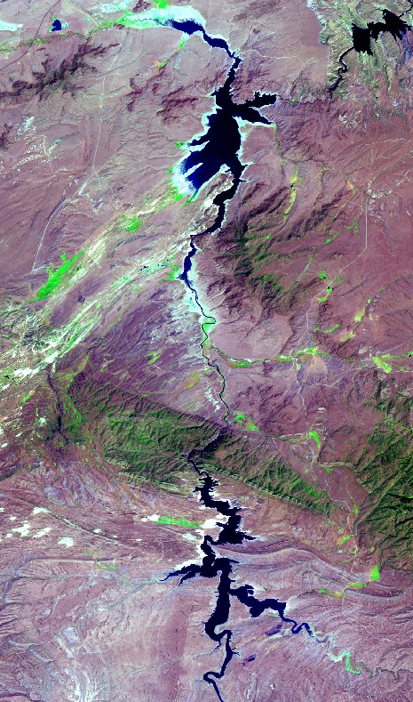
In the example shown above, images acquired in 1986 (normal year) and 2002 (drought year) show the amount of water in Seminole and Pathfinder Reservoirs, in SE Wyoming. Such images are helpful for illustrating concepts in disciplines such as Earth Sciences, Environmental Sciences, and Geography.
Mr. Whitman commented that the “presentation was very helpful in the students understanding of the practical applications of using electromagnetic waves in remote sensing. Students tend to think that only pictures using visible light can be useful in these observations of objects,… use of infrared and ultraviolet waves is quite beneficial”.
This outreach activity was conducted on March 29 and 30, 2010 by Ramesh Sivanpillai, WyomingView coordinator, as part of AmericaView’s Earth Observation Day activities aimed at introducing teachers and students to remote sensing science and applications.